| | Today's Forecast: Snow after 10am. Cloudy, with a high near 5. Wind chill values as low as -12. East wind 2 to 6 mph. Chance of precipitation is 90%. New snow accumulation of 5 to 9 inches possible.
WINTER STORM WARNING
EASTERN RUTLAND COUNTY Details:
* WHAT...Heavy snow expected. Total snow accumulations between 8 and
16 inches. Total snow accumulations for parts of southeastern
Essex County, New York and southern and central Vermont between 13
and 19 inches, locally up to 2 feet possible along the southern
Greens.
* WHERE...Portions of northern New York and all of Vermont.
* WHEN...From 1 PM this afternoon to 1 AM EST Tuesday.
* IMPACTS...Roads, and especially bridges and overpasses, will
likely become slick and hazardous. Travel could be very difficult
to impossible. The hazardous conditions could impact the Monday
morning and evening commutes.
* ADDITIONAL DETAILS...Snowfall rates are likely to exceed one inch
per hours this evening into the overnight hours in the Adirondacks
and much of Vermont.
With the potential for locally 18 inches of greater, like in
southern Vermont, ensure adequate ventilation when heating homes or
using generators to avoid carbon monoxide risks.
Information:
If you must travel, keep an extra flashlight, food, and water in
your vehicle in case of an emergency. For the latest on road
conditions in Vermont, visit https://newengland511.org and for New
York, visit https://511ny.org.
Persons should consider delaying all travel. Motorists should use
extreme caution if travel is absolutely necessary.
Carbon monoxide is a real danger. Ensure adequate ventilation in
homes and do not use generators indoors. Try to conserve the heat
you do have. Close off unused rooms. Stuff towels or rags in cracks
under doors. Cover windows at night. Do not use charcoal inside to
heat homes, lighting candles, use ovens for heating, or sit in cars
running in a garage. If the power fails and you must use an
alternate means to stay warm, use appropriate fire safeguards.
Dress for both the temperature and the wind. Keep your head, hands,
and feet warm and dry. Wear loose fitting, lightweight warm clothing
in several layers. Outer garments should be hooded as well for water
and wind repellent. Snug mittens are better protection from the cold
than gloves. | | | | | Wally's CornerFind us at The Olde Barnyard5444 VT-103, Cuttingsville, VT 05738
February 15th from 10 am to 11am: Good Vibes Jars!🫙 One of our local artisans will be hosting an easy and inspiring craft workshop for the new year! We are going to decorate jars with mod podge and then each week you put a sticky note in it with the best thing that happened to you that week. At the end of the year you will be able to read all the wonderful things you did! Event details can be found on Facebook here, https://www.facebook.com/events/912677401199940/ RSVP here, https://forms.gle/oVWqcBW9HiBUH1URA | | |
| | Today's Forecast:
Sunny and cold, with a high near -2. Wind chill values as low as -31. Northwest wind 7 to 10 mph, with gusts as high as 23 mph.
EXTREME COLD WARNING
EASTERN RUTLAND COUNTY Details:
* WHAT...Dangerously cold wind chills of 20 to 40 below expected.
* WHERE...Northern New York and Vermont.
* WHEN...From 7 PM this evening to 1 PM EST Saturday.
* IMPACTS...The dangerously cold wind chills as low as 20 to 40
below zero could cause frostbite on exposed skin in as little as
10 minutes. Frostbite and hypothermia will occur if unprotected
skin is exposed to these temperatures. An extended period of
freezing temperatures could cause ruptured water pipes. This
period of cold temperatures is particularly dangerous and well
outside of typically experienced temperature conditions. Risk of
hypothermia and frostbite is unusually high, especially for
vulnerable populations like the elderly, children, those that do
not have ready access to adequate heat, or are outdoors and not
taking actions to mitigate these conditions.
* ADDITIONAL DETAILS...Cold conditions will continue beyond 1 PM
Saturday. A Cold Weather Advisory may be needed into Saturday
night, especially for portions of the Adirondacks and Northeast
Kingdom.
Information:
Keep pets indoors as much as possible.
Persons are urged to stay indoors until conditions improve. If you
must go outside, dress in layers. Several layers of clothes will
keep you warmer than a single heavy coat. Cover exposed skin to
reduce your risk of frostbite or hypothermia. Gloves, a scarf, and a
hat will keep you from losing your body heat.
Plan on staying in a location with adequate heating and limit you
time outdoors. Do not use portable kerosene heaters or other
unventilated combustion heating sources indoors. This may lead to
death from carbon monoxide poisoning or cause a fire. Ensure
mitigating actions are being taken, especially for vulnerable
populations. | | |
| | Today's Forecast: Scattered snow showers after 2pm. Partly sunny. High near 15, with temperatures falling to around 8 in the afternoon. Wind chill values as low as -12. West wind 16 to 21 mph, with gusts as high as 37 mph. Chance of precipitation is 40%. New snow accumulation of less than half an inch possible
EXTREME COLD WARNING
EASTERN RUTLAND COUNTY Details:
* WHAT...Dangerously cold wind chills of 20 to 40 below expected.
* WHERE...Northern New York and Vermont.
* WHEN...From 7 PM this evening to 1 PM EST Saturday.
* IMPACTS...The dangerously cold wind chills as low as 20 to 40
below zero could cause frostbite on exposed skin in as little as
10 minutes. Frostbite and hypothermia will occur if unprotected
skin is exposed to these temperatures. An extended period of
freezing temperatures could cause ruptured water pipes. This
period of cold temperatures is particularly dangerous and well
outside of typically experienced temperature conditions. Risk of
hypothermia and frostbite is unusually high, especially for
vulnerable populations like the elderly, children, those that do
not have ready access to adequate heat, or are outdoors and not
taking actions to mitigate these conditions.
* ADDITIONAL DETAILS...Cold conditions will continue beyond 1 PM
Saturday. A Cold Weather Advisory may be needed into Saturday
night, especially for portions of the Adirondacks and Northeast
Kingdom.
Information:
Keep pets indoors as much as possible.
Persons are urged to stay indoors until conditions improve. If you
must go outside, dress in layers. Several layers of clothes will
keep you warmer than a single heavy coat. Cover exposed skin to
reduce your risk of frostbite or hypothermia. Gloves, a scarf, and a
hat will keep you from losing your body heat.
Plan on staying in a location with adequate heating and limit you
time outdoors. Do not use portable kerosene heaters or other
unventilated combustion heating sources indoors. This may lead to
death from carbon monoxide poisoning or cause a fire. Ensure
mitigating actions are being taken, especially for vulnerable
populations. | | | | |
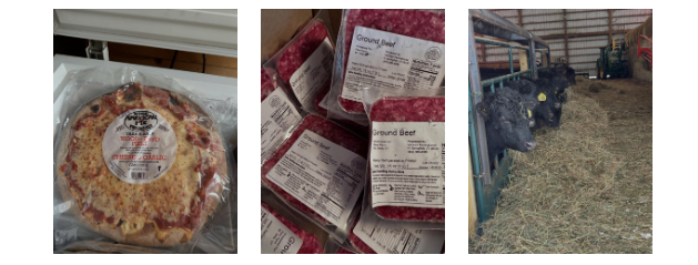
Happy Friday everyone! We are happy to report that we are feeling better and will have our farm stand open this weekend. Thank you all for adjusting your shopping schedules! We are in for a wild weather weekend, are you ready?! Extreme cold (low of 12 below), bitter wind chills (wind chill values of 34 below) and a snow storm (18 - 28 inches) at the end of the weekend! Stay in the loop and follow the Mount Holly forecast here. Eggs are on sale this weekend, just in time for the big storm! Buy 2 dozen, get 1 dozen free. Our farm fresh eggs are so good for breakfast, quiches, baking and more. Stop on by and get some. Ground beef is a must have, especially during the cold and snowy days of winter. Pots of chili, meatloaf, goulash, meatballs and more. And get your slow cookers out as you'll want to get some yummy meals going. We've got stew beef, beef shanks, chuck roasts, and briskets. Or try a whole chicken. Our pork freezer contains pork chops, sausage, ham steaks, ground pork, and ribs. It's always nice to have something quick to throw together for last minute guests. Try one of Goodman's take-and-bake pizzas. Super easy, super quick, and super delicious. Our produce farmers are in a slow down during these cold months, so produce is limited. Stop by for some onions, carrots, and garlic. Be sure to dress for the conditions this weekend folks. We look forward to seeing you here at the farm stand. It's going to be a fun weekend. You can find us at 1966 Healdville Road in Mount Holly, we'll be open all weekend from 12:00-5:00.
| | | | SHOP OUR WEBSITE Maple syrup, maple candy, maple cream, and maple almonds. All available on our website! Our website never sleeps, so you can shop at your leisure. Visit our website for all things maple. From our Vermont maple farm to your family. You shop, we ship.
| |
|
| Plew Farm 1966 Healdville Rd, Mount Holly, VT 05758 | | Farm stand open Thursdays through Sundays from 12:00 - 5:00. 802-259-2250 |
|
|
| | |
| | | | | |